
Stoney Kananaskis Lands Development (SKLD)
Strategic Development Feasibility and Validation
Treaty 7 Territory. Alberta.
Project Context
The Stoney Kananaskis Lands Development site is located at the intersection of Highway 1 and Highway 40, forming a primary access point to Kananaskis Country and the Bow Valley Corridor.
Existing commercial uses include the Stoney Nakoda Resort and Casino, fuel services, and food and beverage operations. The broader region faces structural pressures in workforce housing, transit integration, infrastructure capacity, and coordinated development sequencing.
These conditions required a development strategy capable of unlocking long term economic potential while remaining culturally aligned, financially viable, and executable within Indigenous land governance structures.
UPL1FT’s Role
UPL1FT was engaged to assess whether the lands could support a phased, multi segment commercial development strategy.
The mandate extended beyond land use and market analysis to evaluate governance alignment, infrastructure capacity, funding eligibility, and long term operational sustainability.
UPL1FT integrated governance, infrastructure, market analysis, funding logic, and implementation sequencing into a structured, decision ready advisory framework.
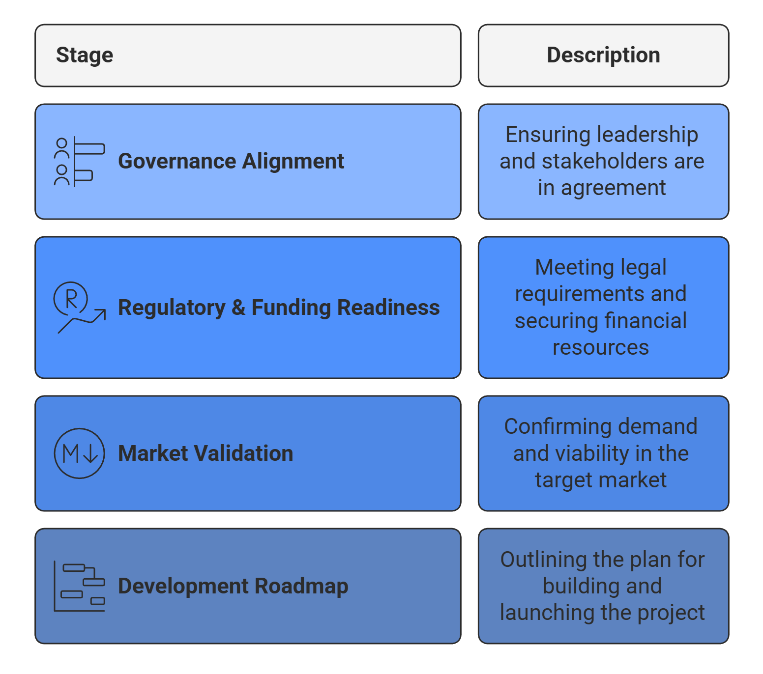
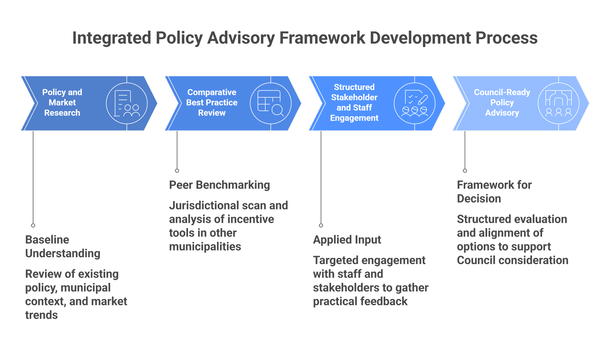
Development Advisory Approach
The methodology prioritized governance clarity, regulatory readiness, and funding eligibility before advancing physical development concepts. Federal and provincial funding pathways were embedded into the analysis from the outset.
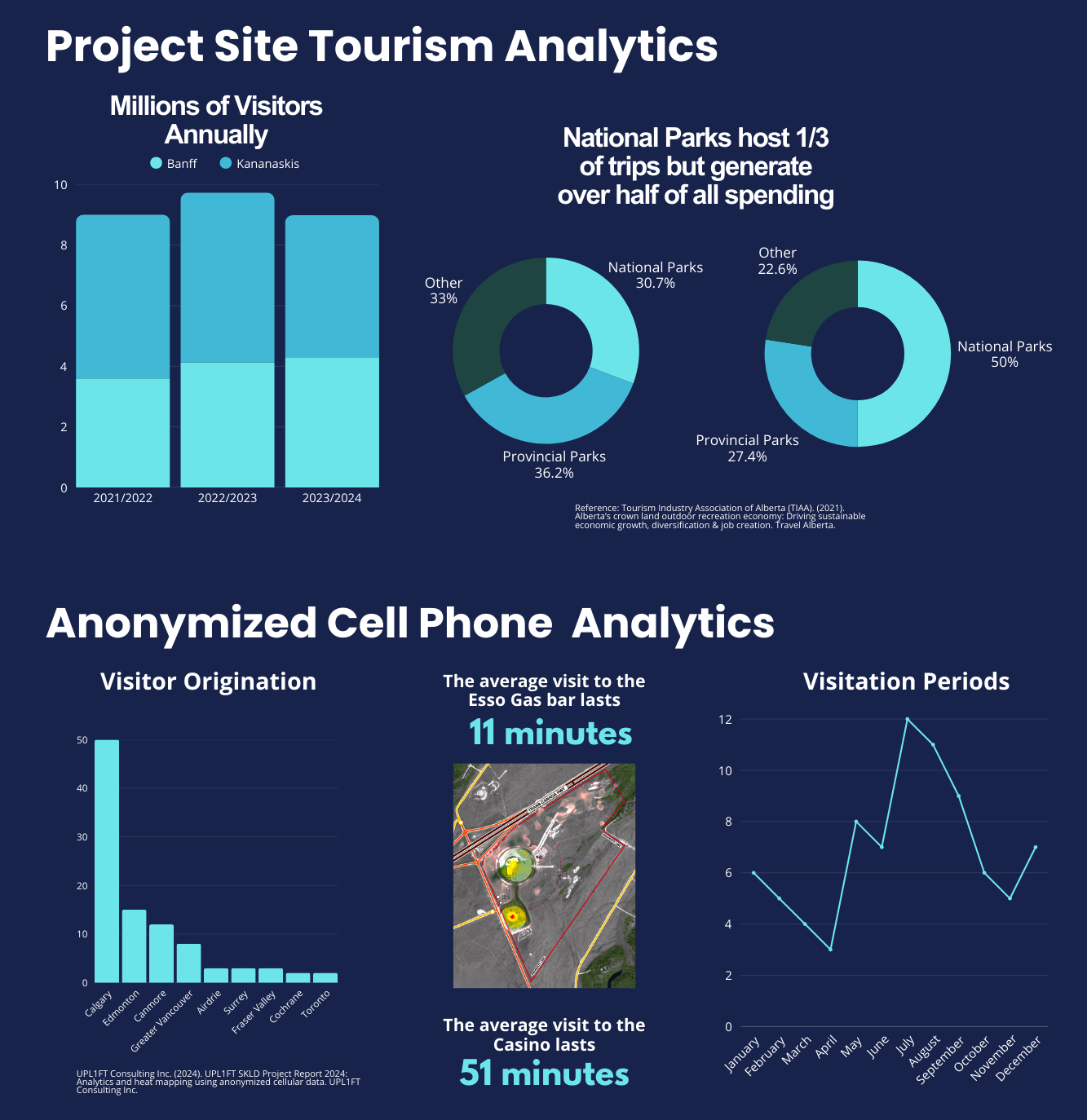
Regional stakeholder engagement and market sounding validated demand and confirmed commercial interest across multiple development segments.
The resulting roadmap balanced cultural stewardship, economic viability, and execution discipline.
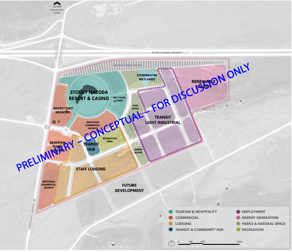
Illustrative land use concepts were planning tools only and did not represent approved plans or commitments.
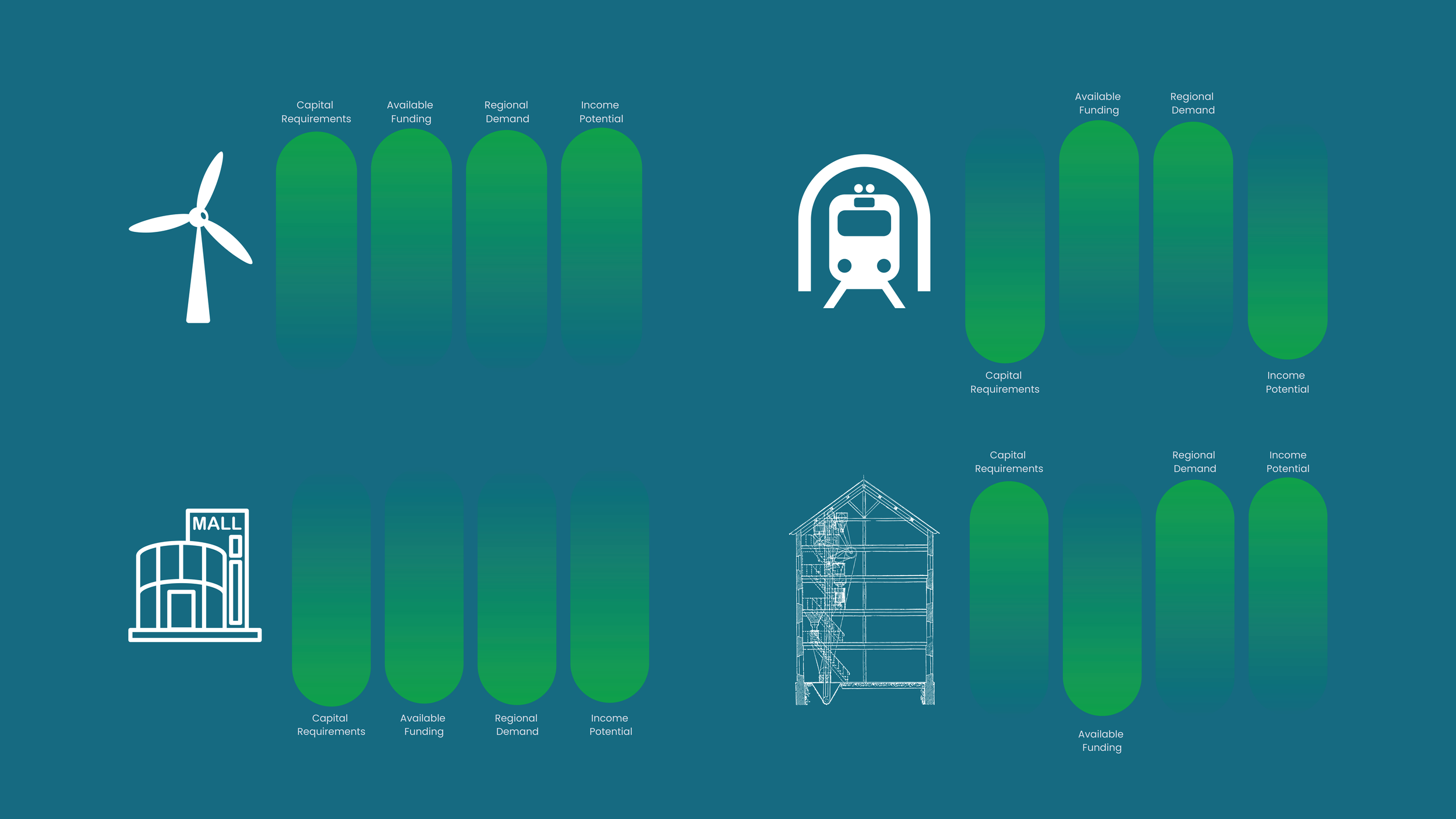
Development Segments Evaluated
The feasibility and validation process evaluated the site as an integrated economic system rather than a single asset.
Governance and Regulatory Framework
Assessment of a unified development governance structure to support coordinated planning, funding access, and regulatory certainty.
Infrastructure Readiness and Capacity
Evaluation of water, wastewater, utilities, transportation access, and servicing constraints, including phased upgrade requirements.
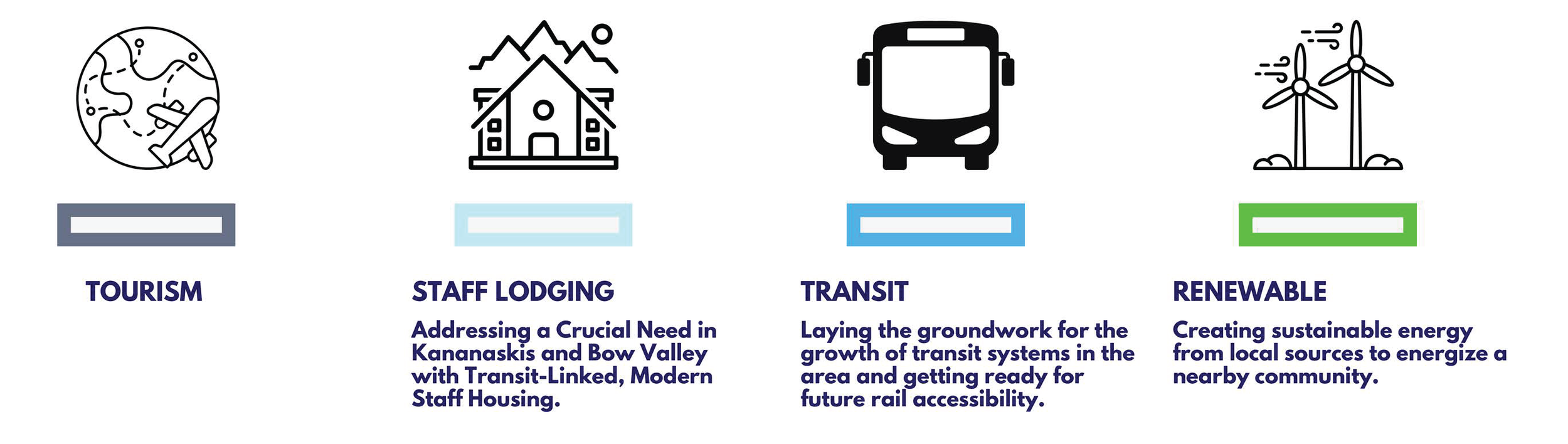
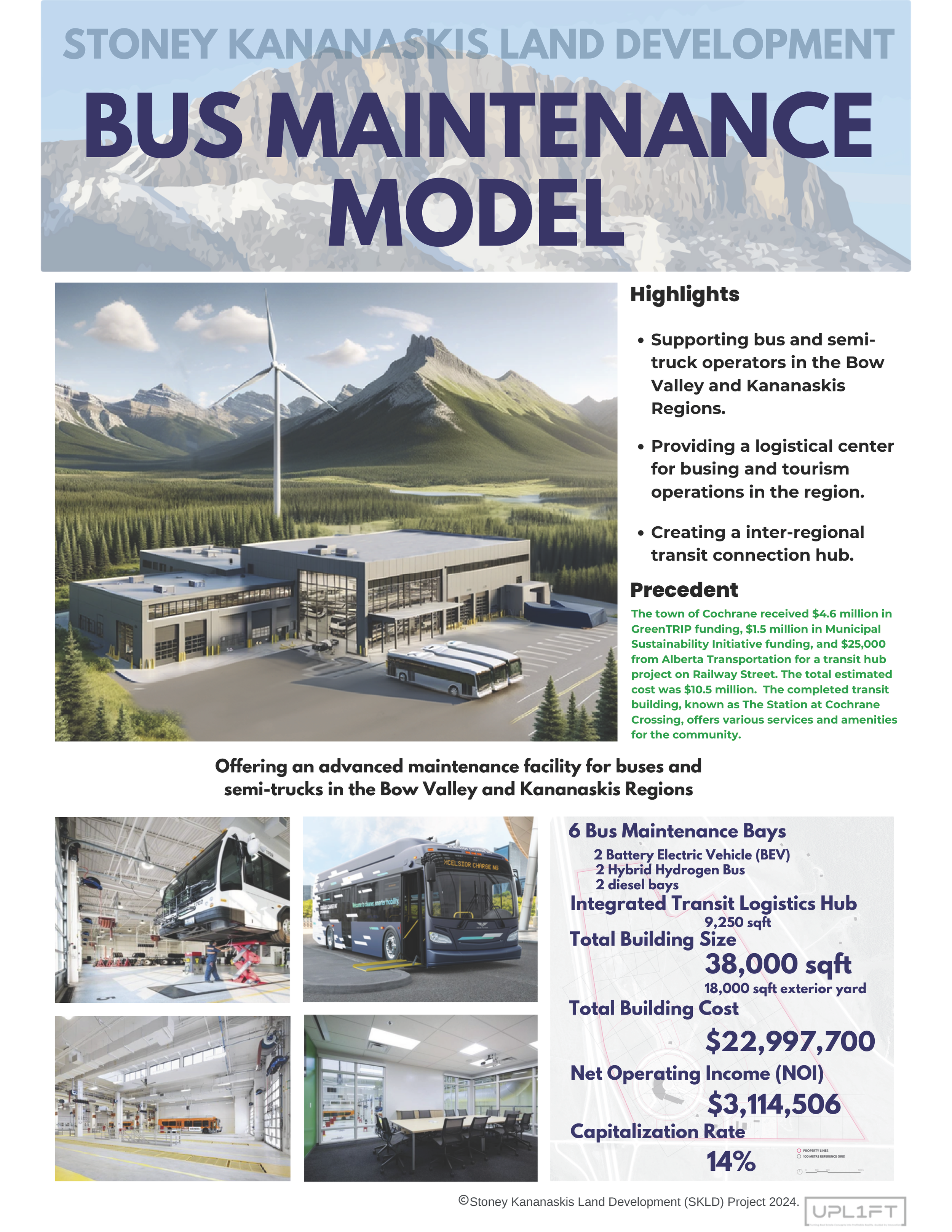
Staff Lodging and Workforce Housing
Feasibility analysis of dormitory-style lodging to address workforce housing shortages in the Bow Valley and Kananaskis region.
Transit and Mobility Hub
Assessment of the site’s role as a regional transit, shuttle, and logistics node serving employees, visitors, and commercial operators.
Commercial and Revenue Generating Uses
Identification of scalable business opportunities aligned with regional traffic volumes and tourism demand.
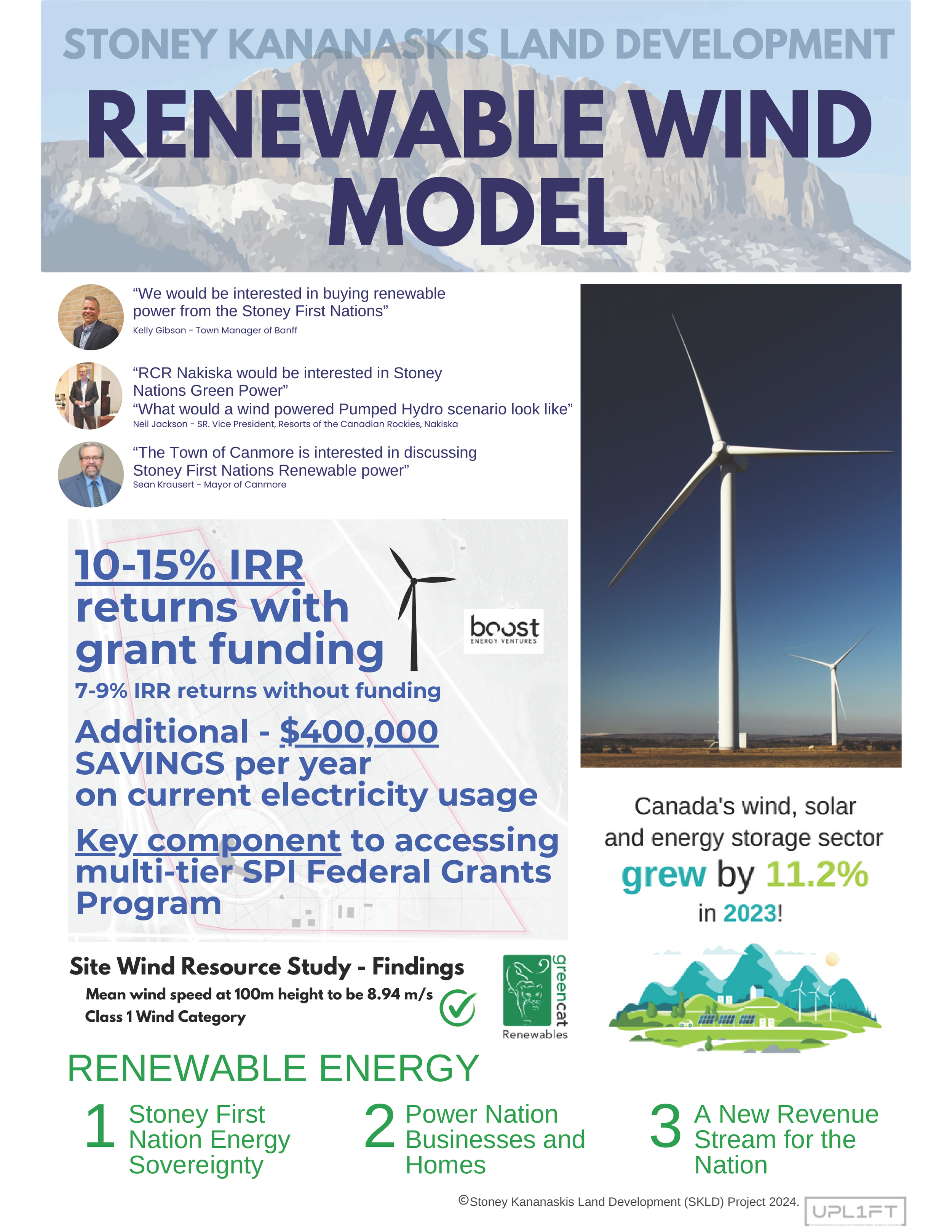
Renewable Energy Integration
Evaluation of wind and clean energy opportunities as infrastructure assets and long-term economic diversification strategies.

Key Findings and Strategic Direction
Phased development is required to manage risk and capital exposure. Governance readiness, infrastructure upgrades, and workforce housing form the initial development sequence.
Staff lodging represents the lowest risk, highest impact entry point, supported by verified employer demand and funding alignment.
Transit and logistics functions strengthen regional integration and site activation.
Renewable energy supports infrastructure resilience and long term economic diversification.
Land Acknowledgment
UPL1FT acknowledges that the Stoney Kananaskis Lands are located on the traditional territories of the Treaty 7 signatories, including the Îyârhe Stoney Nakoda Nations comprised of the Chiniki, Bearspaw, and Goodstoney First Nations. We are grateful for the opportunity to support Indigenous led economic development grounded in stewardship and long term community benefit.
Disclaimer
This work was prepared exclusively for the Stoney Nakoda Nations and associated entities. It is shared for professional reference only. Reuse or reliance on this material for other projects requires authorization. All findings were developed within a specific governance and land tenure context and remain subject to subsequent community decisions and approvals.